- Español
- English
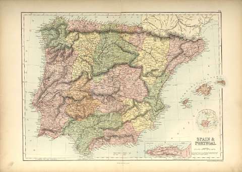
Spain & Portugal : [map]


Library: Regional Library of Madrid
Uniform Title: España. Mapas generales. 1840?
Title: Spain & Portugal [Material cartográfico] : [map] / engraved by S. Hall, Bury Strt. Bloomsbury
Área de datos: Escala [ca. 1:2.100.000]. 70 English Miles [=5,2 cm]
Publication: Edinburgh : Published by A & C Black, [1840?]
Physical description: 1 mapa : col. ; 38 x 51 cm en h. de 45 x 62 cm
Notes: En ángulo superior derecho: 24
Márgenes graduados. Meridiano de origen: Greenwich
Red hidrográfica. En color las divisiones territoriales. Abundante toponimia. Relieve por normales
Pertenece probablemente al Black's Atlas of the World, del que se hicieron numerosas ediciones entre 1840 y 1900
Inserta: Mapa de localización y mapa de Gibraltar
Subject / place / event: España - Mapas
Portugal - Mapas
Other authors: Hall, Selina, m. 1853
A & C Black
Secondary titles: Portugal. Mapas generales. 1840?
Document type:
 Maps
Maps
Copyright:


![]()
© BPCM 2013-2020